 2022-2027 Bond Project: Military Drive (Sequoia Height to East of Reed Road)
2022-2027 Bond Project: Military Drive (Sequoia Height to East of Reed Road)
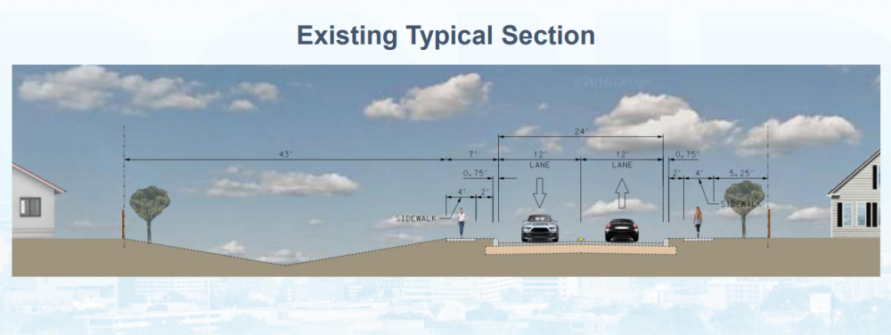
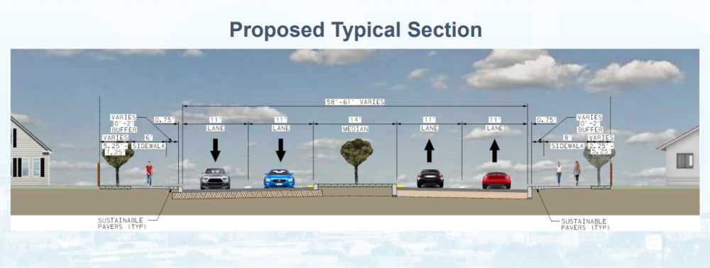
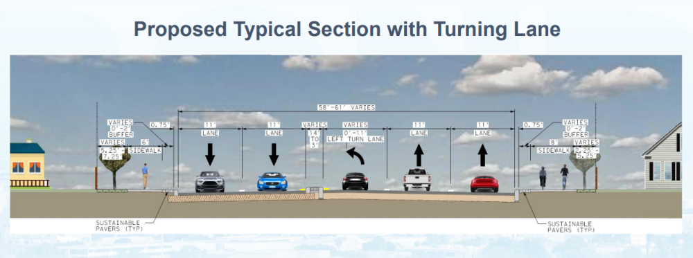
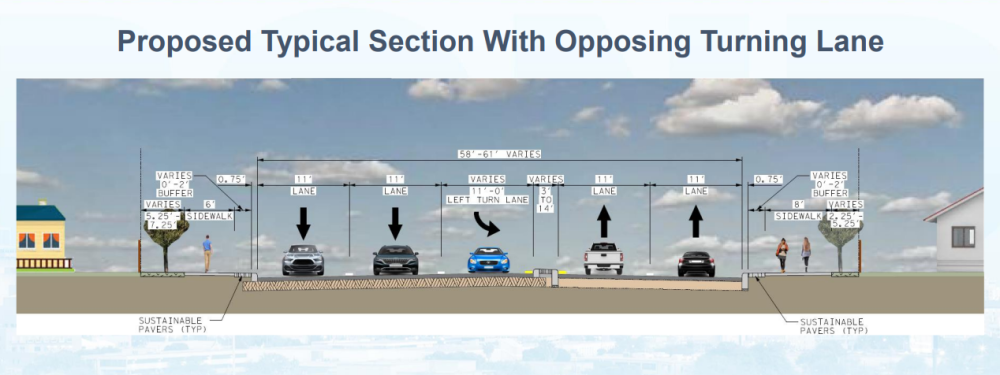
The Bond Project will construct roadway improvements to include sidewalks, curbs, driveway approaches, drainage, bicycle facilities, and other improvements as applicable and within available funding.
Project Type: Streets, Bridges, & Sidewalks
Phase: Construction
Project Contact: Tania Mendoza - (210) 207-6905 - tania.mendoza@sanantonio.gov
Estimated Timeline Construction Seasons are identified as: Winter (January, February, March), Spring (April, May, June), Summer (July, August, September), and Fall (October, November, December.)
Project Budget: | |
2022 General Obligation Bond (Streets) | $ 11,500,000.00 |
San Antonio Water System | $ 104,200.00 |
Tree Preservation Fund | $ 575,000.00 |
Total | $ 12,179,200.00 |

What you need to know
J3 Company continues construction work on the Military Drive project and is making great progress! Here is the latest updates for the area.
Traffic Details:
- Terraces at the Reserve access: Single lane closure at each entrance to the subdivision continues; Richland Hills is Entrance Only - Sequoia Height is Exit Only
- Military Drive: Two-way traffic is maintained at all times throughout construction.
- Pedestrian Access: North sidewalks along Military Drive remain closed. South sidewalk remains open. Clear pedestrian detours are marked.
What we are doing:
- Military Dr. (Reed Rd. to Richland Hills): Pouring concrete (curbs, islands, sidewalks) and finalizing irrigation lines.
- Military Dr. (Richland Hills to Sequoia Height): Continuing underground drainage and irrigation system installations.
- Military Dr. (Sequoia Height to Warren High School): Progressing with street grading, paving, and sidewalk concrete work. This phase is expected to wrap up by Mid-October.
Please note: All work is subject to change and to favorable weather conditions.

Roadway detour map
Overall Project Information
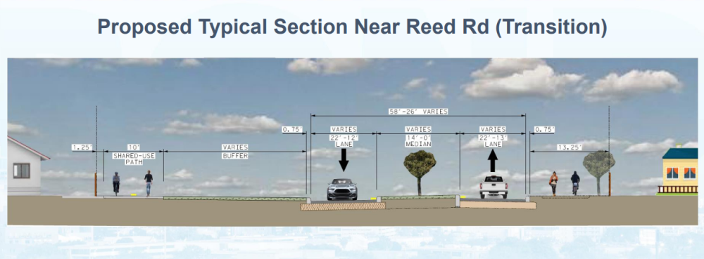
- This project will construct roadway improvements to include additional travel lanes, wider sidewalks, underground drainage, bicycle facilities, and traffic lights.

Military Dr. - South view

North side of Military Dr.

Military Dr. - East view
NOTE TO BUSINESS OWNERS:
If your business is currently or expected to experience construction in your area please visit the City of San Antonio's Construction Toolkit. This guide helps business owners understand and prepare for City-initiated construction projects.
Learn more about City projects in your neighborhood and across San Antonio. The City of San Antonio’s digital dashboards encompass a wide range of projects, including streets, drainage, parks, and facilities.
Please share any feedback or questions about this project.
Project Presentation Documents